 Late Bloom America
The Central Texas Bioregion Is Bumping With Biodiversity


Travis County in Central Texas is 30°18′ north latitude and 97°45′ west longitude. The Texas Northern Blackland Prairies make up the majority of my bioregion but the Edward’s Plateau Woodland, Llano Uplift, Limestone Cut Plains and the Balcones Canyonlands border its edges.
Classification of agroecosystems in this bioregion includes a variety of crops, cattle, sheep, grains, poultry, greenhouses, and mixed farming systems systems. There are a large number of backyard gardens and community gardens. Ecological energetic processes in the agroecosystem include the use of mechanization and chemical fertilizers on the non organic farms that grow grains. Intensified agriculture in this bioregion includes semi-industrial and full industrial (Altieri 1995, 50).
The growing season is about 270 days however there are crops that can be grown year round (Smyrl 2010). The Backland Prairie is predominantly clay and the Edward’s Plateau is a mix of caliche and clay. Agricultural systems include grazing systems for cattle, while there are wildflower programs in place to incorporate native species back into the land along the highways (Altieri 1995, 40). There are gradient changes where ecoregions intersect like in Edwards Plateau and the Blackland Prairies. Cropland, pasture, urban development, industrial growth, and organic farming have altered the Texas Blackland Prairies (Glenn Griffith 2007). “Less than one percent of the original vegetation remains. Restoration activities in some of the protected prairies include prescribed burning, haying, and bison grazing (Glenn Griffith 2007).”
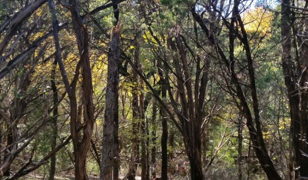
Some examples of the biodiversity in this bioregion include native plants, grasses, trees, succulents, flowers, herbs, and cactus. Trees include Oak, Pecan, Black Walnut, Dogwood, Mesquite, Cedar, Mexican Buckeye, and Texas Ash (Texas A & M Agrilife Extension Service 2013). Shrubs and smaller trees that can be found here include Bottlebrush, American Beautyberry, Crepe Myrtle, and Mexican Redbud (Texas A & M Agrilife Extension Service 2013)
Some of the capital resources include the Ogallala Aquifer and the LCRA controls water from the Colorado River to six damns including the Highland Lakes (Lower Colorado River Authority 2014, Texas Water Development Board n.d.) An extinct volcano makes up part of the Edward’s Plateau (Smyrl 2010). Soil formations are attributed to Cretaceous shale, chalk, marl and of these irregular plains, gradient streams of silt, clay, and sandy substrates are located at an elevation between 300-1050 feet above sea level (Glenn Griffith 2007). The average temperature for Travis County is 67.51°F and the average rainfall for my bioregion is 35.22 inches of rain per year (World Media Group, LLC. 2014).
Spanish settlers and the Mexican government have been a crucial part of indigenous lineage also in the Texas Blackland Prairies (Smyrl 2010). Human resources and the metapopulation include nonprofit organizations, parks, neighborhoods and east side organic farms. The ever-changing region hosts a myriad of culture, industrial development, fauna, agricultural opportunities, native and adapted flora, soil variations, geological land shifts, warm weather, light precipitation, and is a college mecca.
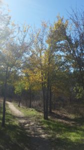
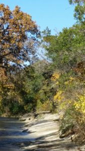
Just after you cross the street to get back on the trail you are able to enjoy the beautiful maple trees turn colors in the fall. This illustrates how the landscape significantly changes within a 2 mile stretch.
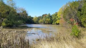
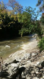
When the river is high you can kayak alongside.
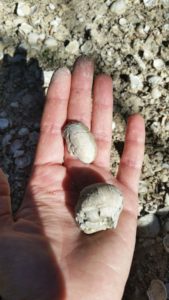
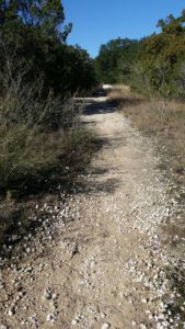
Fossilized seashells indicate oceanic activity years ago.This indicates Edward’s Plateau ecoregion.
Hiking along the bank of Walnut Creek
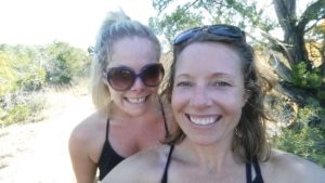
Hiking with my cousin Tabitha near the end of the 2. 2 mile hike one way, at Copperfield Greenbelt Trail in Austin, Texas. Loop back for a hike over 4 miles.
Balcones Canyonland Ecoregion near the trailhead.